Νομιμοποίηση γεώτρησης - Όλες οι μεταβιβάσεις ακινήτων, στα οποία υπάρχει γεώτρηση, εκτελούνται κατόπιν νομιμοποίησης της γεώτρησης. Για να προχωρήσει η συμβολαιογραφική πράξη θα πρέπει να έχει εκδοθεί κωδικός ΕΜΣΥ ενεργού ή ανενεργού σημείου υδροληψίας

Τακτοποίηση εξ αδιαιρέτου εκτός σχεδίου - Σύμφωνα με τις από 12-06-2018 νέες διατάξεις του νόμου 4495/2017 τα εκτός σχεδίου εξ αδιαιρέτου μπορούν να προχωρήσουν σε σύσταση διαίρεσης ιδιοκτησίας κατόπιν αγωγής στο πρωτοδικείο από το 65% των συνιδιοκτητών..

Υγρά απόβλητα παραγωγής καλλυντικών - Υπολογισμός χημικά απαιτούμενου οξυγόνου - .Τα υγρά απόβλητα από την παραγωγή καλλυντικών ελέγχονται ως προς τις απαιτήσεις επεξεργασίας μέσα από ειδική μελέτη επεξεργασίας και διάθεσης πριν την σύνδεση με το κεντρικό δίκτυο αποχέτευσης.

Μελέτη περιβαλλοντικών επιπτώσεων - Τα περισσότερα είδη επιχειρήσεων προκειμένου να εγκατασταθούν ή συνεχίσουν να λειτουργούν χρειάζονται περιβαλλοντική άδεια σε ισχύ. Η άδεια εκδίδεται μετά από την έγκριση της σχετικής μελέτης περιβαλλοντικών επιπτώσεων.

Μελέτη και εγκατάσταση λιποσυλλέκτη - Για τις επιχειρήσεις μαζικής εστίασης, η χρήση λιποσυλλέκτη, κατόπιν υγειονολογικής μελέτης, συμβατής με τα πρότυπα DIN 1986-100α, EN 1825-1+2, DIN 4040-100 είναι υποχρεωτική από την υγειονομική διάταξη Υ1γ / ΓΠ / οικ. 47829 / 17.

Κτηματολόγιο - .Η υποβολή δηλώσεων στο κτηματολόγιο ξεκίνησε, ένας τρόπος για να αποφευχθεί η ταλαιπωρία είναι να υποβληθεί η δήλωση ηλεκτρονικά μέσω ίντερνετ.

Μελέτη προστασίας δεδομένων πελατών (GDPR) - Στις 25-05-2018 τίθεται σε εφαρμογή ο νέος ευρωπαϊκός κανονισμός προστασίας δεδομένων (GDPR), σύμφωνα με τον οποίο όλες οι επιχειρήσεις με Ευρωπαίους πελάτες (περιλαμβανομένων και των Ελλήνων) θα πρέπει να μπορούν να αποδείξουν, με την αναλογούσα μελέτη προστασίας δεδομένων, ότι συμμορφώνονται με τις νέες απαιτήσεις

Ερωτηματολόγιο ΕΟΦ για καλλυντικά - .Ο σχεδιασμός και η λειτουργία ενός εργαστηρίου ή βιομηχανίας καλλυντικών υπάγεται στο πρότυπο GMP Καλής Παρασκευαστικής Πρακτικής και ρυθμίζεται από τον Ευρωπαϊκό Κανονισμό 1223/2009.

Πυρασφάλεια - Πυροπροστασία - Υφιστάμενες επιχειρήσεις εκπαιδευτήριων, χώρων συνάθροισης κοινού, γραφείων και εμπορικών καταστημάτων οφείλουν να επανακαθορίσουν μέτρα και μέσα πυροπροστασίας σύμφωνα με τις νέες διατάξεις (ΠΥΔ 16/15, 3/15, 17/16 & /17).

Τεχνικός ασφαλείας στην εργασία - Όλες οι επιχειρήσεις έχουν την υποχρέωση να διαθέτουν μελέτη επικινδυνότητας από επαγγελματία τεχνικό ασφαλείας εγγεγραμμένο στο μητρώο της επιθεώρησης εργασίας (Ν. 3850/10, άρθρα 12, 42, 43)

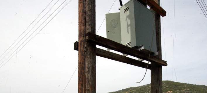
Ηλεκτροδότηση αρδευτικών γεωτρήσεων - Για την ηλεκτροδότηση αγροτικών γεωτρήσεων ή εγκαταστάσεων και την εφαρμογή χαμηλού αγροτικού τιμολογίου είναι υποχρεωτική η έκδοση άδειας χρήσης νερού και του Δελτίου Γεωργοτεχνικών και Γεωργοοικονομικών Στοιχείων..

Κανονισμός λειτουργίας τουριστικού καταλύματος - Τα τουριστικά καταλύματα (ξενοδοχεία, ενοικιαζόμενα, κάμπινγκ) μοριοδοτούνται κατά την πιστοποίηση κατάταξης σε κατηγορία άστρων ή κλειδιών για τον κανονισμό λειτουργίας που διακανονίζει θέματα πολιτικής παραπόνων, υποδοχής, περιβάλλοντος και καθαριότητας.


